Here is the link to that visit
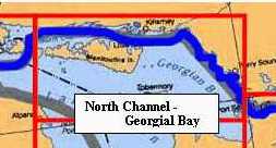
Across the top of Lake Huron - Georgian
Bay and the North Channel
I have to say, by that time we were on a 'mission' and flew a little low--as best you can do in a 9 mph boat.
|
We came through this way heading West in 2005.
Here is the link to that visit
I have to say, by that time we were on a 'mission' and flew a little low--as best you can do in a 9 mph boat. |
After a rest stop in St. Ignace, we are off into the North Channel and
along the Canadian shore.
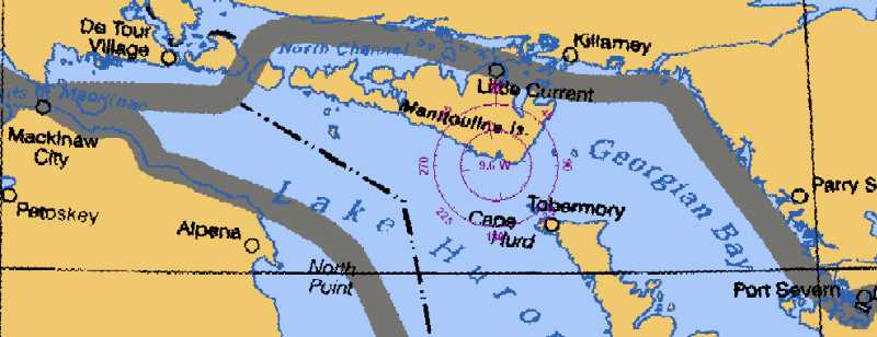
We turned up the St. Mary's River at De Tour pass (just a little to the left of the gray line - the other side of the pass is Drummond Island) and anchored just above Drummond at Harbor Island, a delightful place. The weather was good, the winds were light and the sun was out.
Rather than going due north to Thessalon, Ont we choose to head almost
due east to Blind River. It is just above the 'l' in 'Channel' on the chartlet
above. Blind River was one of our targeted stops and we didn't mind picking
up a day. We checked in with Canadian Customs (ask me about the wine
sometime) and started winding our way along the small boat channels
to Little Current, Killarney, and Port Severn.
We have had nice, leisurely runs as we've headed east out of Blind River.
The longest leg has been something like 20 miles.
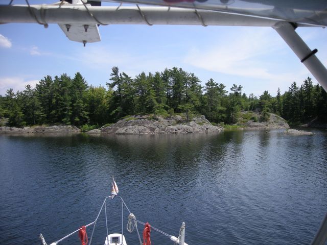 We
spent two nights anchored in John Island Harbor.
We
spent two nights anchored in John Island Harbor.
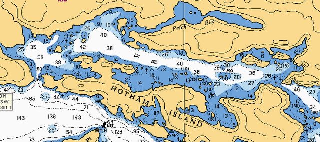 We traveled up
the Whalesback Channel to Hotham Island and spent the night behind it in
Oak Harbor. The next day we explored the harbor a little more and then
went the 8 miles down to South Benjamin.
We traveled up
the Whalesback Channel to Hotham Island and spent the night behind it in
Oak Harbor. The next day we explored the harbor a little more and then
went the 8 miles down to South Benjamin.
Again, click here for
more pictures
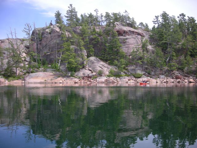
After napping and being lazy in general, we kayaked around the harbor (as the wind shifted from S to SW to W). We were too close to the rocks and I fired up the engines to move the boat.
We must be like the old horse that feels the call of the barn or in
our case the call of the shore power plug!!
We said, "we've seen what we wanted to see, the battery bank is low,
it is 4:00 pm, Little Current is only 2 1/2 hours away, and isn't dark
till 10:00pm".
Once the anchor was up we heeded the call of the power plug and off
we went to Little Current.
June 25, 2008
About here cruising got in the way of web development...
 Click
for Pictures
Click
for Pictures
We spent a couple of days on the newly reburbished town wall in Little
Current and then moved 22 miles south to a wonderful anchorage just above
Killarney, Covered Portage Cove, where we stayed 3 more days. As
usual, we tried to predict the weather and decided that the window was
going to close in a few days. We went down to Killarney to a marina for
a battery charge, pumpout, and fish and chips at the old-red-bus before
taking out across Northern Georgian Bay.
 Our
reading of the weather suggested (and being the wussies that we are, we
listened) that we would be much more comfortable if we took a long day,
skipped an anchorage in the Bustard Islands and a marina in Byng Inlet
we visited in 2005 and moved along to the inlet at Pointe au Baril. As
anticipated, the wind had increased to 15-20 from the stern as we slid
past the rocks into the channel.
Our
reading of the weather suggested (and being the wussies that we are, we
listened) that we would be much more comfortable if we took a long day,
skipped an anchorage in the Bustard Islands and a marina in Byng Inlet
we visited in 2005 and moved along to the inlet at Pointe au Baril. As
anticipated, the wind had increased to 15-20 from the stern as we slid
past the rocks into the channel.
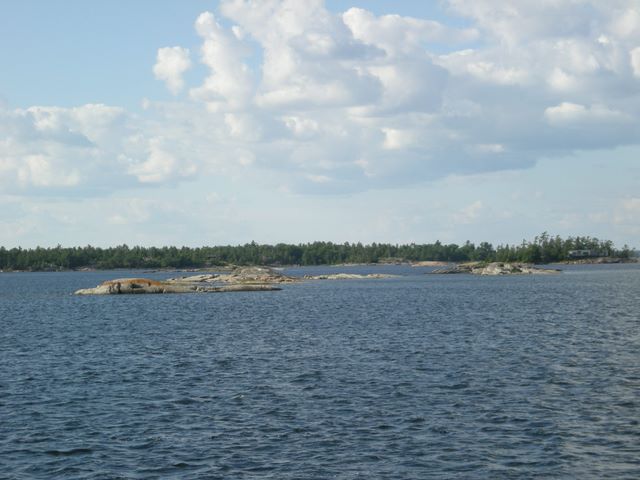
After anchoring for two days in Hopewell Bay, about 5 miles inside on
the Small Boat Channel, we took off for Parry Sound and a great 2 days
(well the first day -even tied up on the pier- was a little rocky). Then
a long trip through the South Channel back to Georgian Bay and down to
a Beausoliel Island and the Beausoliel National Park.
 All of Beausoliel Island
is a National Park. Several anchorages surround it and there are a few
docks. We got there on a Friday about 3:00 pm and there were a couple of
spots on the dock large enough for us. For the rest of the weekend there
was not a spare spot to be had!! We stayed three days - until the 'call
of the plug', the condition of our holding tank, and the chance for fresh
provisions gave us reasons to head 7 miles south to Midland. Midland is
another nice 'real' town. In a couple of days we will go 10
miles up to Port Severn and end our adventures in the North Channel/Georgian
Bay area for this time.
All of Beausoliel Island
is a National Park. Several anchorages surround it and there are a few
docks. We got there on a Friday about 3:00 pm and there were a couple of
spots on the dock large enough for us. For the rest of the weekend there
was not a spare spot to be had!! We stayed three days - until the 'call
of the plug', the condition of our holding tank, and the chance for fresh
provisions gave us reasons to head 7 miles south to Midland. Midland is
another nice 'real' town. In a couple of days we will go 10
miles up to Port Severn and end our adventures in the North Channel/Georgian
Bay area for this time.
It is too pretty and nice to leave forever (for you Texans, think 55 degrees on the 4th of July)
We'll pick up our tale in the Trent-Severn Waterway in a few days (maybe)..
Till Later!!
| Previous Issue (Number 29) | Home | Next Issue (Number 31) |