
The Missouri River merges into the Mississippi at mile 195. The water must have been colder than the Mississippi because when we got to it we drove into thick fog. Thick fog!! And no place to stop and wait for it to lift. .
We turn on the running lights and the automatic fog horn and try to see the shore. We're straining to see anything and watching the radar very carefully. We've got two miles of river travel and then enter into the Chain of Rocks Canal, a ten mile long bypass around a shallow stretch of the river. The towboats are smarter than we are. They don't travel in this stuff (except for the one who whistled at us for a 2 whistle pass -- scared the %$^& out of me).
 We issued
a Securité call as we entered the canal and we were mostly
relieved to hear no response. This 'suggested' that there were no boats
coming at us. Good thing because we could almost not see the banks. The
fog got a little lighter and when we called ahead to Lock 27 requesting
passage we also asked if we could tie up there till the fog lifted.
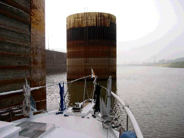
As we locked through the lockmaster said we could turn into the smaller
auxiliary lock entrance and wait there. The auxiliary lock was not in service
for some reason.
We were happy for the courtesy and tied to the approach wall about
10:30.
The fog was burning off and we took off a little after 11:00 when two
other pleasure boats locked through.
We took the picture about 10-15 minutes before we left

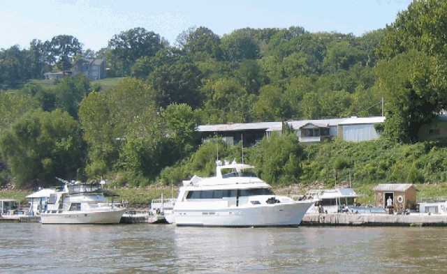
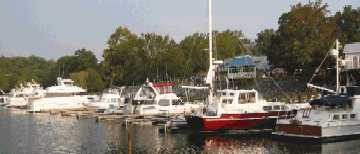
Stopping at Hoppies is almost a 'rite of passage'. You're seeing about half of it. It's a string of barges with a fuel dock and power outlets. We had about 8 cruisers plus at least a dozen local boats tied up the night we were there. Every night Fern, the wife of the owner, gathers the cruisers together and gives a chart-talk about conditions on the river and possible anchorages. We'll pretty much travel with these boats for the next few days.

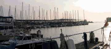
We are on the back side of the southern approach wall. There is room for about 6-7 boats without rafting up on the wall and room for at least that many to anchor. We all brought out the lawn chairs and had cocktails on the wall.
This is the last reliable place to tie up for the next 210 miles.
Seventy miles down the river is the Little River Diversion Canal (mile
48) at Cape Girardeau. This is usually a good (the only) place to stop
short of Cario and the Ohio area. The canal is narrow (we had no problem
turning Letitia around) but a small current flows and we only used 1 anchor.
We anchored in ~7 feet with a river stage of 9.5. I don't know if this
would be a good stop with a stage in the 7 foot range. The Mississippi
can easily rise or drop a foot during the night so you have to catch the
Corp river stage projections.

This guy is five wide by six long. They don't really bother us. We just have to get out of their way. And we want to stay away from their rear end as well. These big guys have three humongous engines and you could surf on their wake.
There are fleeting areas to avoid and some blind curves but the biggest problem for us is at locks. Commercial traffic has priority over pleasure craft and the two locks on the Ohio handle lots of it. After a long day down the Mississippi (we ran from Cape Girardeau) and then up the Ohio (we saw 12 mph going down and 6 going up) we anchored in the river below Lock 52. There were tows lined up to go through the lock when we got there and when we went to bed they were still coming.
That next morning the lockmaster called down to us (there were three
of us - Letitia, Destination, and Classy Lady) to see if we were awake.
He was ready to lock us through. We weighed anchor and scurried over.
Not only getting through Lock 52 (one of the three most conguested
in the country) without having to wait but also getting through early set
us up for a really successful day. A successful day because then we were
able to get through Barkley Lock at the end of the Cumberland River run
before the marina closed for the night.
We were so happy to be able to stop that we stayed at Green Turtle
Bay Marina on Lake Barkley for a week
 |
 |
In the next Issue we head up the Tennessee to Pickwick Lake and our winter quarters.
Till Later!!
| Previous Issue (Number 18) | Home | Next Issue (Number 20) |